Ancient Greek Urban Planning: Grid System, City Layout, and Design
Ancient Greek urban planning was the process of organizing the city to control movement, define functions, and support daily life. Greek cities were not always fully planned from the start, but where planning was applied, it created a clear structure that made activity more efficient and predictable.
What problem did planning solve? It reduced disorder. By arranging streets, public spaces, and buildings in a defined layout, cities could manage how people moved, where trade happened, and how political and social activities were separated or connected.
This is where Greek planning becomes important. It was not just about appearance or symmetry—it was about function. The placement of the agora, the layout of streets, and the division between public and private areas all shaped how the city operated.
This article explains how Greek urban planning actually worked: how cities were organized, how movement was structured, and how planning turned the polis into a functioning system rather than an unplanned settlement.
What Was Greek Urban Planning?
Greek urban planning was the deliberate organization of space within the city to control how activities were distributed and how movement took place. It was not always applied uniformly, but when present, it created a structured layout that made the city easier to manage.
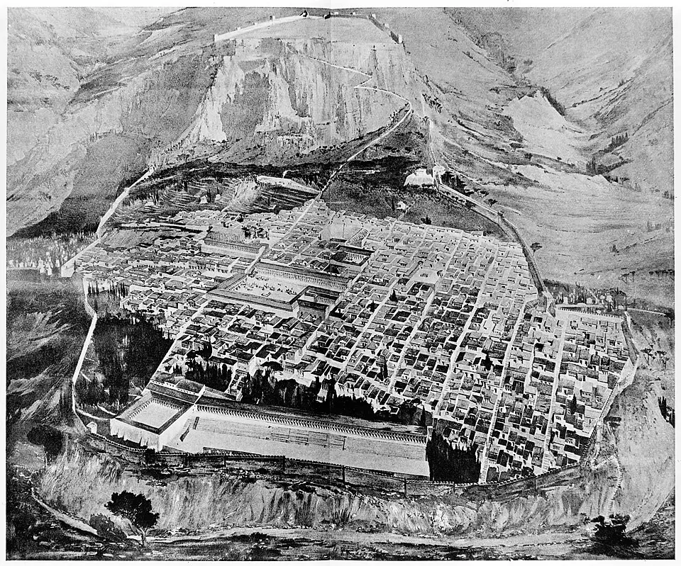
The key distinction is between planned and organic development. Some Greek cities grew gradually, with streets and buildings forming in response to immediate needs. Others were designed with a defined layout from the outset, where streets, blocks, and public areas were arranged according to a clear system.
Planning focused on function. Streets were aligned to guide movement, blocks were shaped to contain residential areas, and central spaces were positioned to concentrate public activity. This reduced randomness and created predictable patterns of use.
It also created separation. Public areas—such as marketplaces and administrative spaces—were distinct from private housing. This allowed different types of activity to operate without interference.
What matters is that Greek urban planning was not about aesthetics alone. It was about organizing the city so that economic, social, and political functions could operate within a controlled spatial framework.
The key point is that planning defined how the city worked. Where it was applied, it turned the urban environment into a structured system rather than an accumulation of buildings.
| Feature | Planned Cities | Organic Cities |
|---|---|---|
| Street Layout | Regular grid with straight lines | Irregular and adaptive paths |
| Movement | Direct and predictable | Less efficient and indirect |
| Space Organization | Clearly defined zones | Mixed and flexible use |
| Expansion | Structured but limited | Flexible but inconsistent |
| Control | Higher level of organization | Lower overall control |
Why City Planning Mattered in Greece
City planning mattered because it reduced inefficiency and made urban activity manageable. Without structure, movement, trade, and public functions would compete for space, creating delays and disorder.
Planning improved movement. Organized streets allowed people and goods to circulate more directly between key areas such as the agora, residential zones, and ports. This reduced time and friction in daily activity.
It also supported economic function. By concentrating trade in defined spaces, cities made exchange more predictable. Producers, traders, and buyers could operate in the same area without constant relocation.
Control was another factor. Defined layouts made it easier to manage crowds, oversee activity, and maintain order. This was especially important in spaces where large numbers of people gathered.
Planning clarified roles. When spaces were designated for specific purposes, behavior became more predictable. People knew where to go for trade, governance, or social interaction, reducing confusion.
The key point is that planning was practical. It was used to organize movement, concentrate activity, and maintain control, making the city function more efficiently within its limits.
The Hippodamian Grid System
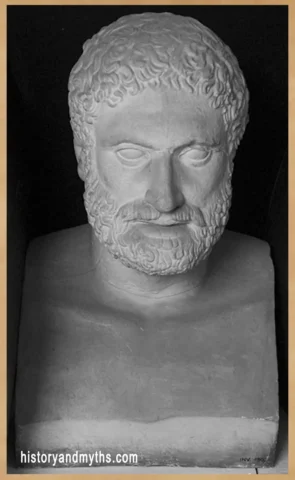
The Hippodamian grid system was a method of organizing the city through straight, intersecting streets that formed regular blocks. It is associated with Hippodamus of Miletus, who is often credited with applying this approach to urban design.
The system worked by dividing space into predictable units. Streets ran at consistent angles, creating a network that made movement straightforward. Blocks defined areas for housing, while larger open spaces were reserved for public functions.
This structure simplified navigation. Instead of irregular paths, the grid allowed direct routes between different parts of the city. This improved movement for both people and goods, making daily activity more efficient.
It also supported organization. By grouping similar functions within defined areas, the grid made it easier to separate public and private spaces. This reduced overlap between activities and helped maintain order.
The system was not applied everywhere. Some cities adopted it fully, especially when built or rebuilt with planning in mind, while others retained more irregular layouts due to existing structures or terrain.
What matters is its purpose. The grid was not designed for visual symmetry alone—it was a practical solution for organizing space, improving movement, and structuring urban activity.
The key point is that the Hippodamian system introduced a clear, repeatable framework for city layout, allowing Greek cities to function with greater consistency and control.
Streets, Blocks, and Movement
Movement in Greek cities was structured through the arrangement of streets and blocks. This layout determined how people, goods, and daily activity flowed between different parts of the city.
Streets functioned as the main routes. In planned areas, they followed consistent directions, allowing direct movement between key locations. Even in less organized cities, primary routes still connected central spaces such as the agora with residential and outer zones.
Blocks defined how space was used. Residential areas were grouped into units that limited internal movement while directing traffic toward main streets. This reduced congestion within neighborhoods and concentrated activity along defined routes.
Flow was intentional. The layout guided movement toward specific destinations—markets, public buildings, and access points leading outside the city. This created predictable patterns instead of random circulation.
Hierarchy improved efficiency. Wider streets handled higher volumes of movement, while narrower ones served local access. This separation reduced interference between different types of traffic.
The system worked by directing activity. Rather than allowing unrestricted movement across all spaces, the city guided it through organized paths, making daily operations more manageable.
The key point is that streets and blocks controlled movement. They shaped how the city functioned by defining where and how activity could take place.
- Urban planning organized movement, activity, and space within the city
- The grid system improved efficiency and predictability
- Streets and blocks controlled how people and goods moved
- The agora acted as the central node of urban activity
- Public and private spaces were functionally separated
- Planning improved order but remained limited by terrain and resources
The Role of the Agora in Urban Layout
The agora was the central node around which the urban layout was organized. It was positioned to be accessible from multiple directions, allowing it to function as the main point where movement and activity converged.
Its placement was deliberate. Streets were often oriented to lead toward the agora, ensuring that economic and social activity remained concentrated rather than dispersed. This reduced fragmentation and made daily interactions more efficient.
The agora also structured surrounding space. Public buildings, administrative areas, and support functions were located nearby, creating a cluster of activity. This allowed different functions—trade, discussion, and coordination—to operate within a connected environment.
Accessibility was essential. By keeping the agora within reach of residential areas, the city ensured regular participation in economic and social life. This made it a consistent point of interaction rather than an occasional destination.
Its role extended beyond trade. Even when not used for exchange, the agora remained a place where people gathered, observed, and interacted. This made it a constant element in the daily operation of the city.
The key point is that the agora was not just a space within the city—it was the center that shaped how the rest of the layout functioned.
Public vs Private Space Organization
Greek urban planning separated public and private space to prevent overlap between different types of activity. This separation was functional, not symbolic. Each area was designed to support a specific role within the city.
Public spaces handled shared activities. Markets, administrative buildings, religious areas, and gathering spaces were located in accessible zones. These areas were open or semi-open, allowing movement, visibility, and interaction.
Private space was organized differently. Residential areas were grouped into blocks, creating a more controlled environment for daily living. Movement within these areas was limited compared to public zones, reducing interference from broader city activity.
This division improved efficiency. By keeping trade, governance, and domestic life in separate areas, the city avoided conflict between functions. Each space could operate without constant disruption from others.
It also shaped behavior. Entering a public space implied participation in wider activity, while private areas were reserved for household life. This created clear expectations about how space was used.
The separation was not absolute, but it was consistent enough to define how the city operated. Public and private zones worked together while maintaining distinct roles.
The key point is that organizing space by function allowed Greek cities to manage different activities without confusion, supporting a more structured and predictable urban system.
Planned Cities vs Organic Growth
Greek cities developed through two main patterns: planned layouts and organic growth. The difference between them affected movement, efficiency, and how activities were distributed.
Planned cities followed a defined structure from the outset. Streets were laid out in a regular pattern, blocks were clearly formed, and public spaces were positioned intentionally. This created predictable routes and made it easier to manage movement and activity.
Organic growth produced a different result. Cities that developed gradually adapted to immediate needs, terrain, and existing structures. Streets were less regular, and movement followed practical paths rather than a predefined system. This often led to irregular layouts and less efficient circulation.
Each approach had advantages. Planned cities offered clarity and control, making daily operations more efficient. Organic cities were more flexible, adapting to local conditions without requiring large-scale redesign.
Terrain influenced both. Even planned cities had to adjust to natural features, while organically developed cities often reflected those constraints more directly.
The key point is that Greek urban environments were not uniform. Some were structured for efficiency, while others evolved through use, but both operated within the same broader system of the polis.
The Limits of Greek Urban Planning
Greek urban planning improved organization, but it remained constrained by practical limits that prevented full control over city development.
The first constraint was terrain. Mountains, slopes, and irregular ground made it difficult to apply uniform layouts. Even planned cities had to adjust their grids, while organically developed cities reflected these constraints more directly.
Resources also limited planning. Constructing and maintaining structured layouts required labor and coordination. Not every city had the capacity to redesign or expand according to a fixed plan.
Growth created pressure. As populations increased, existing layouts became harder to maintain. Expansion often occurred beyond the original plan, introducing irregular areas and reducing overall consistency.
Planning was not universal. Some cities applied structured layouts, while others remained largely unplanned. This meant that urban organization varied significantly across the Greek world.
Infrastructure remained basic. Streets, drainage, and building systems were limited compared to later developments, which restricted how effectively space could be managed.
The key point is that Greek urban planning was effective within its limits but not fully scalable. It improved movement and organization, but it could not eliminate the impact of terrain, resources, and growth on city structure.
- Greek urban planning focused on function, not appearance
- The Hippodamian grid created structured and efficient layouts
- Movement was controlled through organized streets and blocks
- The agora shaped how the entire city operated
- Public and private spaces were separated to reduce conflict
- Planning improved order but could not fully control growth and terrain
Frequently Asked Questions
What is Greek urban planning?
It is the organization of city space to control movement, activity, and structure within the polis.
Who developed the grid system in Greek cities?
Hippodamus of Miletus is commonly associated with the development of the grid layout.
What is the Hippodamian grid system?
It is a layout of straight, intersecting streets forming regular blocks.
Why was urban planning important in ancient Greece?
It improved efficiency, movement, and organization of daily activities.
Were all Greek cities planned?
No, some cities developed organically without a structured plan.
What role did the agora play in city planning?
It acted as the central hub for economic and social activity.
What limited Greek urban planning?
Terrain, resources, and population growth limited its full application.
Sources & Rights
- Wycherley, R.E. How the Greeks Built Cities.
- Hansen, Mogens Herman. Polis: An Introduction.
- Lawrence, A.W. Greek Architecture.
- Osborne, Robin. Classical Greece.
- Snodgrass, Anthony. Archaic Greece.
- Camp, John. The Athenian Agora.
- Whitley, James. The Archaeology of Ancient Greece.
- Cartledge, Paul. Ancient Greece.
- Harris, Edward. The Ancient Greek Economy.
- Finley, M.I. The Ancient Economy.
- Bresson, Alain. The Making of the Ancient Greek Economy.
- Aristotle. Politics.
- Strabo. Geography.
- Herodotus. Histories.
- Thucydides. History of the Peloponnesian War.
- Diodorus Siculus. Library of History.
- Neer, Richard. Greek Art and Archaeology.
- Stewart, Andrew. Classical Greece and the Birth of Western Art.
- Hurwit, Jeffrey. The Acropolis in the Age of Pericles.
- Shipley, Graham. The Greek World After Alexander.
Written by H. Moses — All rights reserved © Mythology and History