The Bridge of Larsa: Water Control in Ancient Mesopotamia
Near the ziggurat of ancient Larsa in southern Iraq, archaeologists are uncovering the remains of a brick bridge that crossed the city’s Grand Canal during the Old Babylonian period. Bricks bearing the name of King Sin-iddinam, who ruled in the nineteenth century BCE, help date its earliest identified construction phase.
The bridge was more than a crossing. Archaeologists interpret it as a dam-bridge, capable of regulating the canal’s flow and allowing it to be dredged. Although reports in November 2026 renewed interest in the site, the structure was identified in 2019, and excavations began in 2021.

Where Was the Ancient Bridge of Larsa?
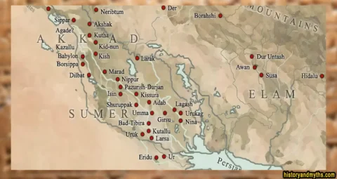
The ancient bridge stood near the center of Larsa, at the archaeological site of Tell es-Senkereh in southern Iraq’s Dhi Qar Governorate. The ruins lie approximately 20 kilometers from Uruk and 40 kilometers from Ur, within the southern Mesopotamian plain. Today, the site lies in an arid landscape, but in antiquity it was connected to an extensive network of rivers and canals linking cities and agricultural land.
The archaeological site covers roughly 200 hectares. Larsa became the capital of a powerful independent kingdom in the early second millennium BCE, with its religious center dominated by the Ebabbar temple, dedicated to the sun god Shamash, and a prominent ziggurat. The kingdom reached the height of its political power under Rim-Sin I before Hammurabi of Babylon conquered the city in 1763 BCE.
The bridge, designated B69 by archaeologists, crossed the Grand Canal (C3) near the ziggurat. This major waterway was generally 20 to 25 meters wide and ran through the heart of the city. Archaeological surveys have identified two other bridges along its course, B25 and B93, showing that B69 was one of several crossing points within Larsa’s urban canal network.
When Was the Bridge of Larsa Discovered?
The first indication of bridge B69 came from geophysical investigations in 2019, when archaeologists identified a possible crossing along Larsa’s Grand Canal. The French-Iraqi mission, led by Régis Vallet, subsequently investigated the site through excavation.
In November 2021, archaeologists opened trench PZ (Pont de la Ziggourat) near the ziggurat. They uncovered a substantial baked-brick pier and part of the canal’s eastern quay, confirming the presence of a bridge. Much of the structure, however, remained buried.
Following further surveys in 2022, the team expanded trench PZ during the November 2023 excavation season. Investigation of the foundations and adjoining masonry revealed two construction phases, designated 4B and 4A. These findings were documented in the mission’s 2024 archaeological report.
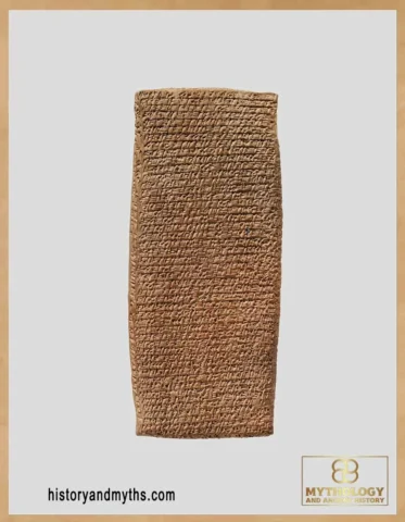
On November 8, 2026, Dhi Qar’s antiquities director, Shamil Al-Rumaidh, reported that approximately half of the bridge had been uncovered. He also announced the discovery of a clay tablet concerning the structure. Its inscription and archaeological context have not yet been published in a detailed scholarly study, leaving its significance uncertain.
How Was the Bridge of Larsa Built?
The bridge rested on massive baked-brick piers constructed within the canal. Its eastern pier, designated 4511, has been exposed over a length of at least 7.6 meters and a width of 4.2 meters. The masonry consists mainly of square bricks measuring 35 centimeters across and 9 to 10 centimeters thick. Smaller bricks were used to stagger vertical joints and adjust the arrangement of the masonry.
The pier survives to a height of approximately 2.9 meters, including its foundations. Its five lowest courses narrow toward the bottom, forming a V-shaped base. Additional foundation pillars provided deeper anchorage. The southeastern pillar (4551), preserved through 20 brick courses, has nine courses bonded to the main pier and another eleven extending into the ground beneath it. A corresponding southwestern pillar was identified but had not yet been fully excavated.
Water penetration was addressed in two ways. Bitumen sealed the joints between bricks in the lower part of the southeastern pillar, while internal drainage passages, approximately 10 to 15 centimeters wide, allowed seepage water to escape through openings in the main pier.
Excavations also exposed secondary brick supports and walls between the main pier and the eastern canal bank. These stood at different elevations, reflecting the canal’s stepped banks rather than a uniformly flat channel bed. The form of the crossing above the surviving masonry, however, has not yet been established.
Dating the Bridge: Sin-iddinam and Later Reconstruction
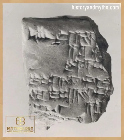
The earliest identified construction phase of Larsa’s bridge, designated Level 4B, is attributed to the reign of Sin-iddinam (1849–1843 BCE). Archaeologists recovered an inscribed brick in 2021, followed by a complete example and two fragments in 2023. All bear the same royal inscription, although differences in their impressions show that several stamps were used.
The text, identified as Sin-iddinam’s inscription no. 3, commemorates his building activities at the Ebabbar temple complex rather than the bridge itself. The bricks support the excavators’ dating of Level 4B, but do not establish a precise construction year. An earlier mud-brick structure beneath wall 4538 also suggests that this phase may include two successive building episodes. Its original configuration remains uncertain.
Between Levels 4B and 4A, archaeologists identified a collapse layer (4543) covered by sandy deposits indicating a period of abandonment. The excavators suggest that this disruption may be connected to Hammurabi’s siege of Larsa in 1763 BCE, during which the city’s water supply was reportedly cut. The association is plausible but has not been established archaeologically.
The bridge was subsequently rebuilt in Level 4A, dated to the eighteenth century BCE through pottery recovered from associated occupation surfaces. Builders filled the space between the eastern pier and the quay, connecting the pier to the canal bank and narrowing the waterway to approximately eight meters. They also added a new brick facing and reconstructed adjoining walls.
After this final phase, the canal fell out of use and gradually filled with sediment. During the Kassite period, a pottery workshop occupied the former canal area, leaving a later archaeological layer above the Old Babylonian remains.
Read Also
How Did the Bridge Help Control the Grand Canal?
Archaeologists interpret bridge B69 as a dam-bridge, combining a crossing with a means of controlling water flow. Its supporting piers and walls connecting the structure to the canal bank suggest that sections of the Grand Canal could be closed when necessary. This would have allowed workers to isolate stretches of the waterway for dredging, removing accumulated silt without draining the entire canal.
The wider hydraulic network helps explain this interpretation. Farther upstream, bridge B93 had massive brick supports anchored into the canal embankments, indicating a similar water-control function. Nearby basin P22 could collect overflow during maintenance or store water diverted from the upper canal. Channels C8 and C130 directed excess water westward, where it could be stored in basin P20 and used for irrigation.
The excavations at B69 have not established precisely how the channel was closed. Its hydraulic function remains an archaeological interpretation based on the surviving masonry and comparisons with other structures along the Grand Canal.
The Bridge in Larsa’s Economy and Urban Life
The Grand Canal formed part of Larsa’s wider transport network. Near the royal palace, archaeologists identified buildings interpreted as possible warehouses along canal C9, which branched from the Grand Canal. Their location suggests that river traffic may have reached the city’s administrative center, although excavation is needed to confirm the buildings’ functions.
Farther south, excavations and surveys revealed a port with internal canals arranged in a zigzag pattern to accommodate numerous docking places. The complex included a large building interpreted as a warehouse, while its outer basin (P7) was enlarged under Sin-iddinam. Waterways also supported agriculture within the city walls. Surveys identified approximately 30 hectares of cultivated land in northwestern Larsa and a smaller irrigated area near canal C4 to the southeast.
Although these discoveries establish the importance of canals to Larsa’s economy, the specific traffic across B69 remains unknown. No archaeological evidence identifies the goods transported over the bridge or the institutions responsible for its operation.
Conclusion
The importance of Larsa’s bridge lies in its surviving construction history. Its foundations, inscribed bricks, and successive rebuilding phases provide evidence of how engineers maintained and modified a major canal crossing during the Old Babylonian period.
Although the precise operation of its water-control system remains uncertain, B69 provides physical evidence of how bridge construction and canal maintenance were connected in an Old Babylonian city.
Academic Sources & Primary Texts
- Vallet, Régis, ed. Larsa–’Oueili Annual Report 2022–2023. State Board of Antiquities and Heritage, Republic of Iraq, 2024. See especially Costanza Coppini et al., “Trench ‘PZ’ Across the Grand Canal of Larsa,” pp. 56–63, and Dominique Charpin and Antoine Jacquet, “Epigraphic Discoveries from the 2021–2023 Campaigns,” pp. 87–90.
Full archaeological report (PDF). - Vallet, Régis, and Antoine Jacquet. “Preliminary Results of the 2021–2022 Campaigns at Larsa, Iraq.” In Proceedings of the 13th International Congress on the Archaeology of the Ancient Near East, vol. 2, edited by Ingolf Thuesen, Scott Haddow, and Camilla Mazzucato, 375–387. Wiesbaden: Harrassowitz Verlag, 2025.
DOI. - Vallet, Régis, ed. Larsa–’Uwaili Annual Report 2021–2022. Baghdad: State Board of Antiquities and Heritage of Iraq, 2022. Includes field reports on the Grand Canal, bridge B69, and Larsa’s hydraulic network.
Read report. - Frayne, Douglas R. Old Babylonian Period (2003–1595 BC). The Royal Inscriptions of Mesopotamia, Early Periods, vol. 4. Toronto: University of Toronto Press, 1990. See pp. 160–161, Sin-iddinam inscription no. 3, concerning construction at the Ebabbar temple.
Publisher’s edition. - Charpin, Dominique. “Les prêtresses de Šamaš à Larsa et leur résidence.” Isimu 25 (2022): 87–101. Provides historical and epigraphic context for the Ebabbar sanctuary and Sin-iddinam’s royal building inscriptions.
DOI.
Copyright & Attribution
© 2026 History & Myths. All rights reserved. Article by H. Moses. Historical and archaeological information is based on the academic research and excavation reports cited above. Rights to referenced publications, archaeological photographs, and other third-party materials remain with their respective owners. Image credits and applicable licenses are provided separately.